How to Verify Survey Number and Property Boundaries
Learn how to verify a Telangana property's survey number, sub-division, extent and physical boundaries against records before buying.
Jameendar Editorial · · 4 min read
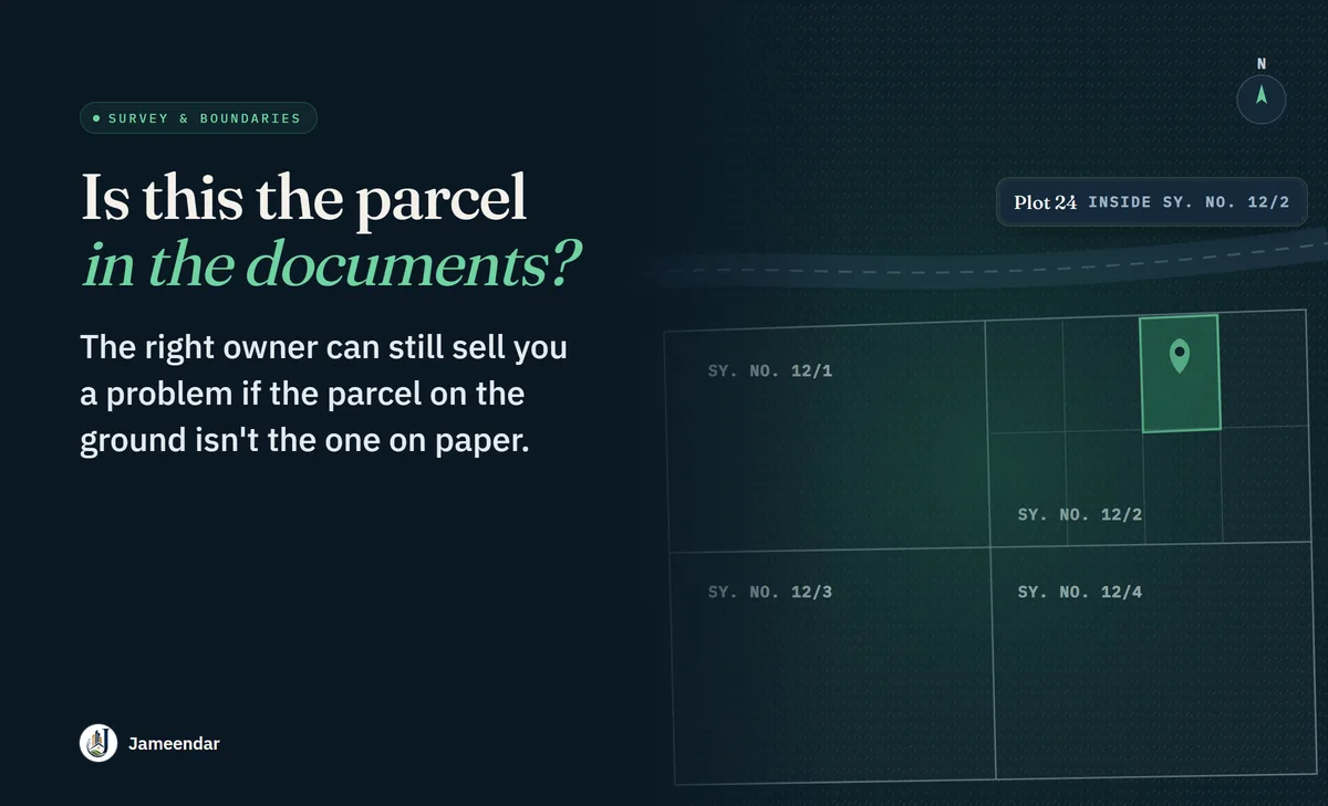
A property can have the right owner and still create a problem if the parcel being sold is not the parcel described in the documents.
That is why survey number verification and boundary checks deserve their own step in Telangana property due diligence. It connects the legal description of the property to the piece of land you are actually buying.
What should match?
At minimum, compare:
- District
- Mandal/local jurisdiction where relevant
- Village/locality
- Survey number
- Sub-division number, if applicable
- Extent/area
- Plot number, where applicable
- Four boundaries or other identifying description
- Physical access and location
Not every property will use every identifier in the same way. The important thing is consistency across the documents and records that apply to that property.
Step 1: Start with the current sale/title document
Record the exact survey number, sub-division and extent instead of relying on a broker's description such as “Plot 24 near the main road.”
Photographs and maps are useful, but the legal identifiers should come first.
Step 2: Compare with current land records
For land with agricultural/revenue history, use the current Bhu Bharati record to cross-check the survey/sub-division and extent.
Look for differences such as:
- different survey number;
- different sub-division;
- different extent;
- land shown as acquired or otherwise restricted; or
- ownership/record information that does not align.
A discrepancy is a reason to investigate, not something to “adjust” on the agreement.
Step 3: Check whether the survey number has been subdivided
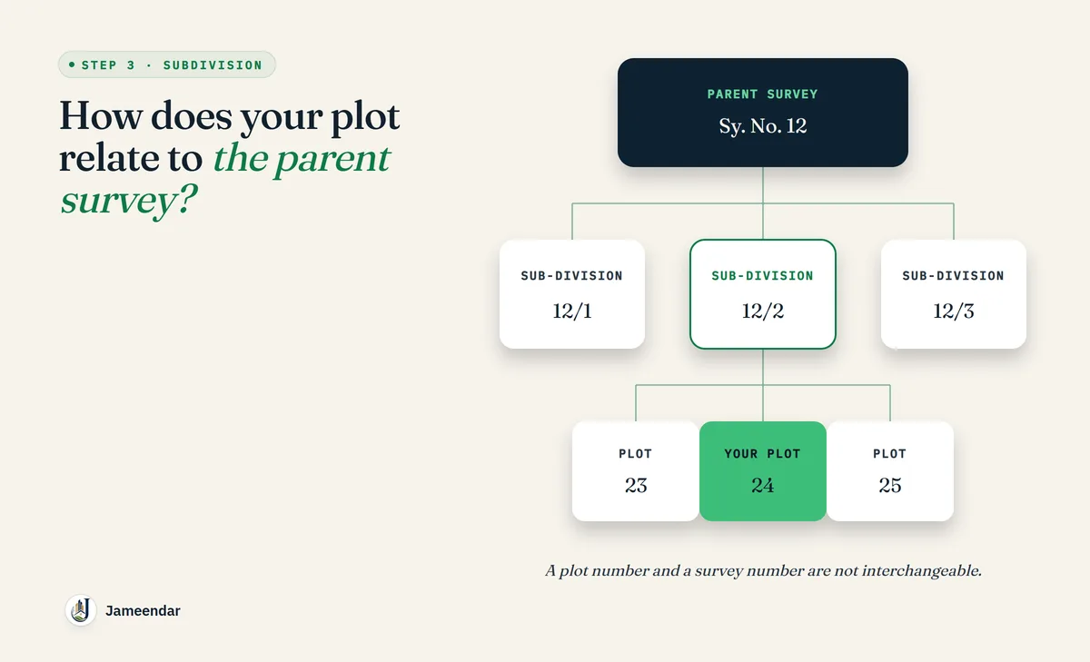
Large agricultural parcels may later be subdivided into smaller parcels or plotted developments.
Understand how the current plot relates to the parent survey number. Ask for the relevant subdivision/layout/survey documents where applicable.
Step 4: Compare the paper boundaries
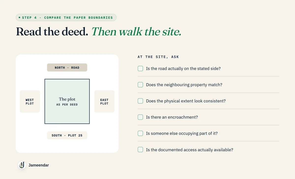
Read the boundaries in the deed. Then visit the property.
Ask:
- Is the road actually on the stated side?
- Does the neighbouring property match?
- Does the physical extent look consistent?
- Is there an encroachment?
- Is someone else occupying part of the land?
- Is the access shown in the documents actually available?
Step 5: Get an independent survey when the parcel matters
For a plot or land purchase, an independent licensed/qualified survey professional can provide valuable physical verification.
The purpose is not simply to measure the land. It is to compare the physical parcel with the documentary description and identify discrepancies before purchase.
Common boundary problems
Boundary descriptions are old
Neighbouring land may have changed hands or been developed.
Fencing is not proof of legal boundary
A fence shows occupation, not necessarily legal entitlement.
Plot number is mistaken for survey number
A layout plot number and the underlying survey number are not interchangeable.
Access is assumed
A road shown on a brochure may not answer the legal access question.
Parent survey history is ignored
A plotted property may originate from a larger survey parcel with a more complicated history.
What to do when records conflict
Do not choose the document that gives you the better-looking answer.
Create a discrepancy list and identify which authority or professional can resolve each item. If the extent differs between the deed and current record, for example, obtain the underlying survey/subdivision information before proceeding.
If the conflict affects the identity or extent of the property, consider pausing the transaction entirely until it is resolved.
A buyer's field checklist
Before site visit:
- Print/download the relevant property documents.
- Mark survey/sub-division and extent.
- Note the stated boundaries.
At site:
- Confirm physical location.
- Check access.
- Compare neighbouring boundaries.
- Look for occupation/encroachment.
- Take location photographs.
After site visit:
- Reconcile the physical observations with the records.
- Obtain surveyor input where necessary.
FAQs
Is a plot number enough?
Usually it should not be your only identifier. Understand the underlying survey/sub-division and the approved layout or parcel documentation where applicable.
Is a survey number enough without a plot number?
Not necessarily. For a plotted development, you need to identify the actual plot within the relevant parent survey and layout documentation.
Can I verify boundaries online?
Some record information can be checked online, but physical boundaries and access require a site-level check.
When should I hire a surveyor?
When buying land or plots where the exact extent, subdivision or boundary matters, especially when documents or physical features do not line up.
Final takeaway
The question is not just “Does the document have a survey number?”
The question is: Does the survey number, sub-division, extent, boundary description and physical property all identify the same parcel?
That is the standard buyers should aim for.